STOP: CALIFORNIA AQUEDUCT
LISTEN/DOWNLOAD [MP3]
SB CUE When you see the Dos Amigos Pumping Station to the east of I-5
NB CUE Nees Ave. or the Dos Amigos Pumping Station Vista Point
SITE
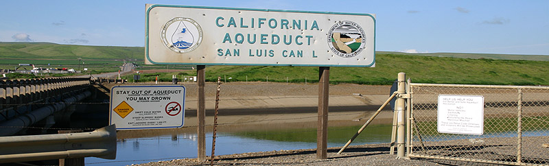
California Aqueduct
View LANDSAT Map
LOCATION
Throughout the state
THREATS AND CONTAMINANTS
Water quality, water subsidies, inequity in infrastructure development and common-pool resource access
VOICE
John Gibler, writer, Edmund "Pat" Brown, Former California Governor
California's two monumental water projects, the State Water Project (SWP) and the federally funded Central Valley Project (CVP) are the largest of their kind in the world. Both convey water from the northern part of the state to the southern end with many disbursements in between. Twenty-nine water contractors including urban and agricultural water agencies, buy water from the SWP totaling over four million acre-feet a year with seventy percent going to urban users and thirty percent to agricultural users. The CVP on the other hand provides one-fifth of the state's domestic and irrigation water, approximately seven million acre-feet annually. Ninety percent of this amount goes to agricultural uses and about half of this amount is historically provided to farmers for free.
Considered its crown jewel, the SWP's Edmund G. Brown California Aqueduct is the state's largest and longest water transport system, stretching 444 miles from the Sacramento-San Joaquin Delta in the north to Lake Perris in Southern California. The aqueduct and associated channels supply water for about one million acres of farmland. Pitched during Brown's tenure as governor, the SWP was initially sold to the public in 1960 for an estimated total cost of $1.75 billion in state bonds-a misleading and low-balled figure. Construction began in 1961 and though still incomplete, the total cost for the project has grown over $4.3 billion for twenty-five dams and reservoirs, eighteen pumping plants, 683 miles of aqueducts, and eight hydro-electric power plants. In a 1979 interview with the University of California's Oral History Program Brown commented, "I was absolutely determined I was going to pass this California Water Project. I wanted this to be a monument to me."
LISTEN/DOWNLOAD [MP3]
SB CUE When you see the Dos Amigos Pumping Station to the east of I-5
NB CUE Nees Ave. or the Dos Amigos Pumping Station Vista Point
SITE
California Aqueduct
View LANDSAT Map
LOCATION
Throughout the state
THREATS AND CONTAMINANTS
Water quality, water subsidies, inequity in infrastructure development and common-pool resource access
VOICE
John Gibler, writer, Edmund "Pat" Brown, Former California Governor
California's two monumental water projects, the State Water Project (SWP) and the federally funded Central Valley Project (CVP) are the largest of their kind in the world. Both convey water from the northern part of the state to the southern end with many disbursements in between. Twenty-nine water contractors including urban and agricultural water agencies, buy water from the SWP totaling over four million acre-feet a year with seventy percent going to urban users and thirty percent to agricultural users. The CVP on the other hand provides one-fifth of the state's domestic and irrigation water, approximately seven million acre-feet annually. Ninety percent of this amount goes to agricultural uses and about half of this amount is historically provided to farmers for free.
Considered its crown jewel, the SWP's Edmund G. Brown California Aqueduct is the state's largest and longest water transport system, stretching 444 miles from the Sacramento-San Joaquin Delta in the north to Lake Perris in Southern California. The aqueduct and associated channels supply water for about one million acres of farmland. Pitched during Brown's tenure as governor, the SWP was initially sold to the public in 1960 for an estimated total cost of $1.75 billion in state bonds-a misleading and low-balled figure. Construction began in 1961 and though still incomplete, the total cost for the project has grown over $4.3 billion for twenty-five dams and reservoirs, eighteen pumping plants, 683 miles of aqueducts, and eight hydro-electric power plants. In a 1979 interview with the University of California's Oral History Program Brown commented, "I was absolutely determined I was going to pass this California Water Project. I wanted this to be a monument to me."