STOP: WEST OAKLAND
LISTEN/DOWNLOAD [MP3]
SB CUE When you merge on to the South 880 ramp
NB CUE Hegenberger Rd. / Coliseum exit
SITE
West Oakland
View LANDSAT Map
LOCATION
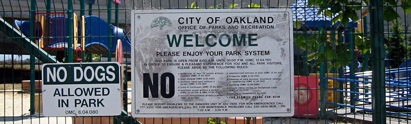
South Prescott Park is located at 3rd St. & Chester Avenue; across from the AMCO Chemical Superfund site at 114 3rd St.
THREATS AND CONTAMINANTS
AMCO site, former Red Star Yeast Factory, diesel emissions, particulate matter, vinyl chloride, lead
VOICE
Renee Morrison, Chester Street Block Club Association
South Prescott is a historically significant eight-block neighborhood in West Oakland, bounded by Seventh Street to the north, Peralta Street to the west, Nelson Mandela Parkway to the east, and Third Street to the south. West Oakland is the poorest neighborhood in the Bay Area, where fifty-five percent of households earn less than $25,000 per year. More than sixty percent of the 24,000 residents of West Oakland are African American and eighty-nine percent are people of color, according to the 2000 Census.
Health threats for people living in West Oakland include lead and other toxic contamination in South Prescott Park, a vinyl chloride plume, diesel truck traffic fumes originating from three freeways that interchange above the neighborhood, and intensive shipping and traffic at the Port of Oakland - where a planned expansion could generate 22,000 truck trips per day by 2010. Thousands of diesel trucks travel through West Oakland daily, dropping off and picking up containers from the Port, which is the fourth busiest in the nation. Average diesel emissions per square mile in West Oakland are more than ninety times greater than average emissions for the rest of the state. West Oakland children are seven times more likely to be hospitalized for asthma than other California children.
In a 2003 victory for West Oakland residents, members of the community and a coalition led by the Chester Street Block Club Association (CSBCA) with Greenaction and others, successfully forced the shutdown of the Red Star Yeast Plant at Fifth and Mandela after residents learned that the factorys foul-smelling emissions contained Illegal and dangerous levels of acetaldehyde - a carcinogen, neurotoxin, and developmental toxin produced when sugar is metabolized by yeast during fermentation. Before its closure, the factory had emitted 30,000 pounds of acetaldehyde annually under an exemption for businesses involved in food processing.
LISTEN/DOWNLOAD [MP3]
SB CUE When you merge on to the South 880 ramp
NB CUE Hegenberger Rd. / Coliseum exit
SITE
West Oakland
View LANDSAT Map
LOCATION
South Prescott Park is located at 3rd St. & Chester Avenue; across from the AMCO Chemical Superfund site at 114 3rd St.
THREATS AND CONTAMINANTS
AMCO site, former Red Star Yeast Factory, diesel emissions, particulate matter, vinyl chloride, lead
VOICE
Renee Morrison, Chester Street Block Club Association
South Prescott is a historically significant eight-block neighborhood in West Oakland, bounded by Seventh Street to the north, Peralta Street to the west, Nelson Mandela Parkway to the east, and Third Street to the south. West Oakland is the poorest neighborhood in the Bay Area, where fifty-five percent of households earn less than $25,000 per year. More than sixty percent of the 24,000 residents of West Oakland are African American and eighty-nine percent are people of color, according to the 2000 Census.
Health threats for people living in West Oakland include lead and other toxic contamination in South Prescott Park, a vinyl chloride plume, diesel truck traffic fumes originating from three freeways that interchange above the neighborhood, and intensive shipping and traffic at the Port of Oakland - where a planned expansion could generate 22,000 truck trips per day by 2010. Thousands of diesel trucks travel through West Oakland daily, dropping off and picking up containers from the Port, which is the fourth busiest in the nation. Average diesel emissions per square mile in West Oakland are more than ninety times greater than average emissions for the rest of the state. West Oakland children are seven times more likely to be hospitalized for asthma than other California children.
In a 2003 victory for West Oakland residents, members of the community and a coalition led by the Chester Street Block Club Association (CSBCA) with Greenaction and others, successfully forced the shutdown of the Red Star Yeast Plant at Fifth and Mandela after residents learned that the factorys foul-smelling emissions contained Illegal and dangerous levels of acetaldehyde - a carcinogen, neurotoxin, and developmental toxin produced when sugar is metabolized by yeast during fermentation. Before its closure, the factory had emitted 30,000 pounds of acetaldehyde annually under an exemption for businesses involved in food processing.