STOP: INTERSTATE 5
LISTEN/DOWNLOAD [MP3]
SB CUE 152/Monterey/Los Banos - Jct. 1 mi.
NB CUE Hwy 152/33 South/Los Banos/San Jose
SITE
I-5
View LANDSAT Map
LOCATION
From the border of Canada to the border of Mexico
THREATS AND CONTAMINANTS
Diesel emissions, particulate matter
VOICE
Richard Walker, Professor of Geography, UC Berkeley
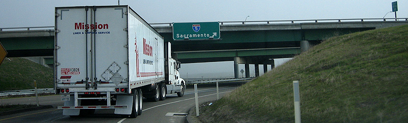
Interstate 5 is a high-speed controlled access highway running north/south along the West Coast, through California, Oregon, and Washington, between the Canadian and Mexican borders. Influenced by the military potential of the German autobahn, Dwight D. Eisenhower in 1956 proposed the National Defense Highway System, a project to create a national roadway infrastructure for military troop movement and for mass evacuation of cities in the event of nuclear attack. The I-5 opened during the 1960s.
The Interstate system superceded the US and state highway system and sometimes overlays the older roads. Through the San Joaquin Valley the I-5 runs parallel to the west of US 99, the older major north/south highway. While the 101 also runs north/south through California, I-5 is considered an "Intermodal Corridor of Economic Significance." A major NAFTA shipping route, I-5 moves freight between the ports of Oakland and Long Beach, and urban centers and distribution hubs along the west coast. "You can't look at California and the West Coast without focusing on Interstate 5," said former Caltrans Director Jeff Morales. "It is the backbone of the state. It is the backbone of the region."
The Bay Area was briefly connected to the I-5 by the I-5W, a western spur of the Interstate that completed the route between San Francisco and Los Angeles. The I-5W signage was replaced by I-580 and I-505 by the mid-1960s.
LISTEN/DOWNLOAD [MP3]
SB CUE 152/Monterey/Los Banos - Jct. 1 mi.
NB CUE Hwy 152/33 South/Los Banos/San Jose
SITE
I-5
View LANDSAT Map
LOCATION
From the border of Canada to the border of Mexico
THREATS AND CONTAMINANTS
Diesel emissions, particulate matter
VOICE
Richard Walker, Professor of Geography, UC Berkeley
Interstate 5 is a high-speed controlled access highway running north/south along the West Coast, through California, Oregon, and Washington, between the Canadian and Mexican borders. Influenced by the military potential of the German autobahn, Dwight D. Eisenhower in 1956 proposed the National Defense Highway System, a project to create a national roadway infrastructure for military troop movement and for mass evacuation of cities in the event of nuclear attack. The I-5 opened during the 1960s.
The Interstate system superceded the US and state highway system and sometimes overlays the older roads. Through the San Joaquin Valley the I-5 runs parallel to the west of US 99, the older major north/south highway. While the 101 also runs north/south through California, I-5 is considered an "Intermodal Corridor of Economic Significance." A major NAFTA shipping route, I-5 moves freight between the ports of Oakland and Long Beach, and urban centers and distribution hubs along the west coast. "You can't look at California and the West Coast without focusing on Interstate 5," said former Caltrans Director Jeff Morales. "It is the backbone of the state. It is the backbone of the region."
The Bay Area was briefly connected to the I-5 by the I-5W, a western spur of the Interstate that completed the route between San Francisco and Los Angeles. The I-5W signage was replaced by I-580 and I-505 by the mid-1960s.