STOP: CROWS LANDING
LISTEN/DOWNLOAD [MP3]
SB CUE Crows Landing 4
NB CUE Crows Landing Exit 1mi.
SITE
The Covanta Incinerator
View LANDSAT Map
LOCATION
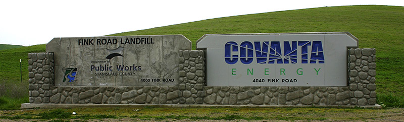
Covanta Stanislaus, Inc., 4040 Fink Road, Crows Landing
THREATS AND CONTAMINANTS
Hazardous waste incineration, dioxin and toxic air contaminants, soil and groundwater pollution from incinerator ash
VOICE
John Mataka, Grayson Neighborhood Council, Bradley Angel, Greenaction for Health and Environmental Justice
The west side of Stanislaus County has multiple toxic sites, including dumps, waste incinerators, Superfund sites, and industrial Brownfields. Polluting sites on the west side include the Naval Air Logistics Force Superfund site (VOCs, heavy metals, and petroleum byproducts), the Paul Oil Co. (a commercial oil recycling plant), and the F & A Dairy, which releases eleven tons of nitrogen oxides per day.
The Covanta garbage incinerator is located just west of I-5 at the Crows Landing exit. In presently importing and burning 800 tons of garbage per day, the incinerator emits dioxin and metals into the air, and threatens to contaminate the soil from byproduct buried at the nearby Fink Road Landfill and through diesel exhaust generated by trash hauling.
While Covanta claims that the design and technology of their incinerator system results in low atmospheric emissions of pollutants, the facility continues to produce and emit dioxin from its smokestack in the incineration of chlorinated plastics like polyvinyl chloride (PVC), according to Bradley Angel of Greenaction. In 2000, Westside Stanislaus residents, Grayson Neighborhood Council (GNC) and Greenaction successfully defeated plans to ship in and burn toxic medical waste at the Covanta incinerator.
The Grayson Neighborhood Council (GNC) is a community and environmental justice group working to assist the Westside residents of Stanislaus County to defend themselves from disproportionate and discriminatory pollution threats, including attempts to operate and site noxious facilities in their midst. GNC is working toward the closure and remediation of existing toxic facilities and sites that currently threaten Westside residents' health.
LISTEN/DOWNLOAD [MP3]
SB CUE Crows Landing 4
NB CUE Crows Landing Exit 1mi.
SITE
The Covanta Incinerator
View LANDSAT Map
LOCATION
Covanta Stanislaus, Inc., 4040 Fink Road, Crows Landing
THREATS AND CONTAMINANTS
Hazardous waste incineration, dioxin and toxic air contaminants, soil and groundwater pollution from incinerator ash
VOICE
John Mataka, Grayson Neighborhood Council, Bradley Angel, Greenaction for Health and Environmental Justice
The west side of Stanislaus County has multiple toxic sites, including dumps, waste incinerators, Superfund sites, and industrial Brownfields. Polluting sites on the west side include the Naval Air Logistics Force Superfund site (VOCs, heavy metals, and petroleum byproducts), the Paul Oil Co. (a commercial oil recycling plant), and the F & A Dairy, which releases eleven tons of nitrogen oxides per day.
The Covanta garbage incinerator is located just west of I-5 at the Crows Landing exit. In presently importing and burning 800 tons of garbage per day, the incinerator emits dioxin and metals into the air, and threatens to contaminate the soil from byproduct buried at the nearby Fink Road Landfill and through diesel exhaust generated by trash hauling.
While Covanta claims that the design and technology of their incinerator system results in low atmospheric emissions of pollutants, the facility continues to produce and emit dioxin from its smokestack in the incineration of chlorinated plastics like polyvinyl chloride (PVC), according to Bradley Angel of Greenaction. In 2000, Westside Stanislaus residents, Grayson Neighborhood Council (GNC) and Greenaction successfully defeated plans to ship in and burn toxic medical waste at the Covanta incinerator.
The Grayson Neighborhood Council (GNC) is a community and environmental justice group working to assist the Westside residents of Stanislaus County to defend themselves from disproportionate and discriminatory pollution threats, including attempts to operate and site noxious facilities in their midst. GNC is working toward the closure and remediation of existing toxic facilities and sites that currently threaten Westside residents' health.