STOP: KERN WATER BANK
LISTEN/DOWNLOAD [MP3]
SB CUE Hwy. 119
NB CUE Hwy. 119
SITE
Kern Water Bank
View LANDSAT Map
LOCATION
The I-5 crosses over the 20,000 acre Kern Water Bank at CA-119
THREATS AND CONTAMINANTS
Privatization of natural resources, loss of democratic control of and access to water
VOICE
John Gibler
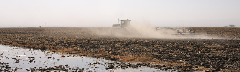
The Kern Water Bank is an underground water storage facility - the largest of its kind - located in the lower San Joaquin Valley near Bakersfield. Created over thousands of years, the water bank is in actuality a naturally occurring aquifer sustained by runoff from the Kern River and other tributaries originating from the Sierra Nevada. In the early part of the twentieth century farmers and ranchers drained the aquifer dry through excessive overdrafts, which has dropped the valley floor as much as eight feet in towns like Maricopa.
State agencies early on recognized the potential for water storage in the empty aquifer during drought years. Through a process referred to as recharge, the water bank could be replenished by flooding the land above it. Water would eventually seep down into the subterranean reserve, where it could be stored for long periods with little loss from evaporation. In 1988, the CA Department of Water Resources (DWR) purchased 19,900 acres adjacent to the Kern River for $74 million dollars, establishing the Kern Water Bank, capable of storing one million acre-feet of water. The Kern Water Bank is an integral part of California's public water delivery system and was activated during the drought years of 1991, 1992 and 1994.
A series of closed-door meetings in 1994 led to the creation of a document known as the Monterey Amendments. During these meetings, the DWR agreed to turn the water bank over to the Kern County Water Agency, which signed it over to the Kern Water Bank Authority, a supposedly public entity comprised of a collection of water districts and one private company - Westside Mutual Water Company - a "paper company" owned by Paramount Farming Company, which in turn is owned by Roll International Corporation-one of the largest privately owned companies in the world.
The privatization of the Kern Water Bank raises concerns that the largest agribusinesses and development corporations in the nation are manipulating the state's complex and opaque water governance process to market and resell state-subsidized water back to Californians at a profit, further undermining equitable access to and distribution of water in California.
LISTEN/DOWNLOAD [MP3]
SB CUE Hwy. 119
NB CUE Hwy. 119
SITE
Kern Water Bank
View LANDSAT Map
LOCATION
The I-5 crosses over the 20,000 acre Kern Water Bank at CA-119
THREATS AND CONTAMINANTS
Privatization of natural resources, loss of democratic control of and access to water
VOICE
John Gibler
The Kern Water Bank is an underground water storage facility - the largest of its kind - located in the lower San Joaquin Valley near Bakersfield. Created over thousands of years, the water bank is in actuality a naturally occurring aquifer sustained by runoff from the Kern River and other tributaries originating from the Sierra Nevada. In the early part of the twentieth century farmers and ranchers drained the aquifer dry through excessive overdrafts, which has dropped the valley floor as much as eight feet in towns like Maricopa.
State agencies early on recognized the potential for water storage in the empty aquifer during drought years. Through a process referred to as recharge, the water bank could be replenished by flooding the land above it. Water would eventually seep down into the subterranean reserve, where it could be stored for long periods with little loss from evaporation. In 1988, the CA Department of Water Resources (DWR) purchased 19,900 acres adjacent to the Kern River for $74 million dollars, establishing the Kern Water Bank, capable of storing one million acre-feet of water. The Kern Water Bank is an integral part of California's public water delivery system and was activated during the drought years of 1991, 1992 and 1994.
A series of closed-door meetings in 1994 led to the creation of a document known as the Monterey Amendments. During these meetings, the DWR agreed to turn the water bank over to the Kern County Water Agency, which signed it over to the Kern Water Bank Authority, a supposedly public entity comprised of a collection of water districts and one private company - Westside Mutual Water Company - a "paper company" owned by Paramount Farming Company, which in turn is owned by Roll International Corporation-one of the largest privately owned companies in the world.
The privatization of the Kern Water Bank raises concerns that the largest agribusinesses and development corporations in the nation are manipulating the state's complex and opaque water governance process to market and resell state-subsidized water back to Californians at a profit, further undermining equitable access to and distribution of water in California.